Arctic Expedition
1960

|
USS SARGO (SSN 583)
Arctic Expedition |

Click on the pictures to enlarge!
|
VADM John Nicholson recounts his experiences during the 1960 Winter Arctic
Exploration cruise:
“Nautilus' course into the polar regions had been through the Bering and Chukchi Seas -- the shallow route into the deep North Canadian Basin, some 75 degrees north latitude. But even in the summer her way was blocked repeatedly by deep ice ridges extending as much as 80 feet down from the surface. Time after time she had been forced to backtrack and try new routes before she got through. And once, the boat (which measured 50 feet from keel to top of sail) passed under an 80-foot deep ridge in 142 feet of water, leaving only six feet clearance above and below! Because Nautilus's sonar couldn't detect deep ice ridges until they were virtually overhead, Commander Anderson had broken off the mission., Nautilus returned to Pearl Harbor, was refitted with the proper equipment and eventually made a successful transit to the Pole. |
 Courtesy John Nicholson
|
 Courtesy John Nicholson
|
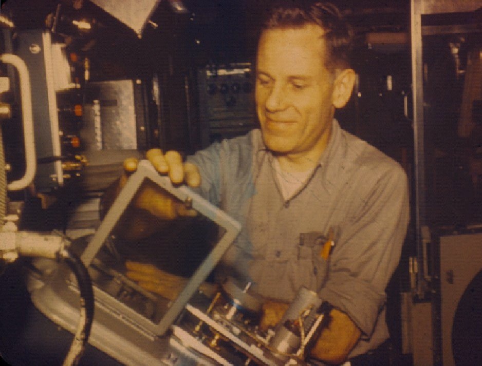
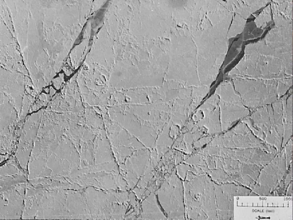
| Dr. Waldo K. Lyon | Aerial Photo of the Ice Pack |
|
“Getting Sargo ready made for the most hectic four months imaginable. Yard
workers labored frantically, even on Christmas and New Year's Day, to finish
the job on time. Then immediately after installation was completed, Sargo was
off for sea trials. The inertial navigation system was tested, vertical ascents
and descents were practiced, and the new iceberg detector was tried out. This
was tested using another submarine in place of the ice ridges the Sargo would
face. From these exercises we were able to check out the equipment, learn its
range capability, estimate depths of "ice ridges", and familiarize ourselves
with appearances of various objects on the scope of the overhead sonar.
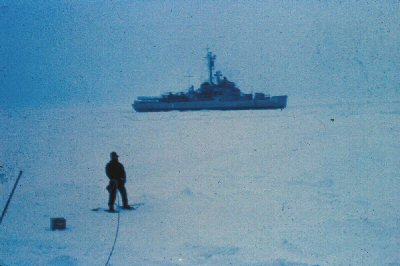
“We were ready to leave for the north when I got a pessimistic letter from an old friend from my days aboard Skate, Walt Witmann, the Navy's senior ice forecaster. He predicted, after reconnoitering the northlands, that the winter would be a particularly tough one. Bering Strait, the gateway to the Arctic from the Pacific side, might have such deep ice ridges it could be closed to submarine traffic. With that letter in my pocket I slept uneasily the last few nights before we cast off for the north. But I kept the bad news to myself. One week out of Pearl, Sargo surfaced. We had made good time underwater past the Aleutian and Pribilof Islands, and was nearing Saint Matthew Island in the Bering Sea, still some 1,800 miles from the North Pole. A navigational fix was needed before going under the edge of the ice pack, which was only a few miles north. In fact I was much aware of ice as Sargo was cautiously surfaced with periscope and antennae retracted into the sail. Such caution moreover paid off. As Sargo broke the surface, chunks of ice bounced off her, making sharp rapping sounds on the hull. Seals cavorted about, and dead ahead was the solid edge of the ice pack. We were at the starting line and now our work had begun. “We then contacted the Staten Island, one of the five U.S. icebreakers. She was thirty-one miles to the north. Our orders were to rendezvous with her before we began the long and difficult Arctic exploration. |
 Courtesy Robert Connelly
|
 Courtesy Robert Connelly
|
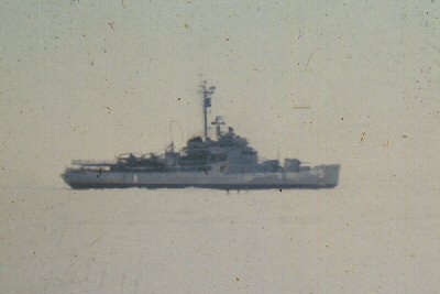
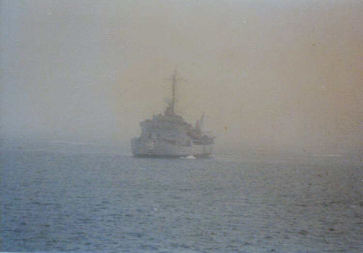
| Photo of the STATEN ISLAND (AGB 5). | Photo of the STATEN ISLAND (AGB 5). |
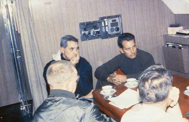
| "We closed with Staten Island after a vertical dive out of the drift ice around us, and tested our iceberg detector and overhead sonar as we went. Close by the icebreaker, we established underwater telephone contact with her, then surfaced nearby. Commodore Robertson, the Royal Canadian Navy's top Arctic expert, and Staten Island's skipper, Comdr. Larson, came aboard for a one-day, under-ice demonstration on Sargo. Later, during the night as we cruised close to the Staten Island, the ice thickened directly overhead. Eager to transfer the two officers back to the icebreaker so Sargo could resume her transit through Bering Strait, I found that getting her back up through the heavy polar winter ice cap was no simple problem. |
 Courtesy James Smallwood
|
 Courtesy John Nicholson
|
| Photo of the STATEN ISLAND (AGB 5). | A meeting in the Wardroom with Commodore Robertson. |
|
"We searched for a frozen polynya or lake with our upward beamed echo sounder.
When one was found we performed a Williamson Turn to go back down our track
and find the polynya. We maneuvered to place Sargo in the middle of the
polynya and then began a vertical ascent with pumping and flooding of ballast
to control her upward rate. (if the overhead ice was hit too hard, serious
damage to the sail with its periscopes, masts, antennae, and other
indispensable equipment might occur. If Sargo didn't hit hard enough, she
wouldn't break through.)
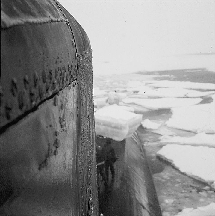
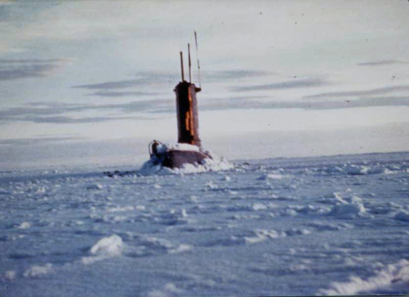
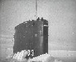
“Sargo bumped the underside of the ice. Nothing happened. She hadn't broken through. The sonar showed one of the 25-foot deep ridges of ice was closing in on Sargo rapidly. Quickly negative tank was flooded and Sargo dropped to a keel depth of 120 feet. “We soon located another polynya, positioned Sargo and again tanks were blown cautiously until with an echoing bump Sargo rammed sail-first though the overhead ice. Then there was nothing. Sargo was hung up. I ordered Lt. Fred Stelter, our diving officer, to blow the ballast tanks. Almost immediately, with grinding and crunching sounds all around her, Sargo broke the rest of the way through the ice and into the air near the patiently waiting Staten Island. “I raised the periscope and saw the icebreaker 300 yards on Sargo's starboard beam. The only other thing I could see was solid ice all around. Opening the upper hatch, I went to the bridge and all but stumbled over the cockpit full of ice, the thickest any submarine had ever penetrated. On the after deck was an enormous block of ice five feet thick and measuring 15 by 20 feet - a 13-ton ice cube. |
 Courtesy John Nicholson
|
 Courtesy Bill Hyde
|
| Surfaced in the Bering Sea | Surfaced in the Bering Sea |
|
“After letting the Commodore and the Commander walk over to the Staten Island,
we flooded tanks, dropped vertically toward the bottom, and steered northward.
At dawn the next day, Sargo cracked through the ice forty-one miles off Saint
Lawrence Island for a final navigational fix before running submerged through
the shallow Bering Strait. The day was bright and so clear that the hills of
Saint Lawrence Island could be seen. One long last look at the world above the
surface was taken. We were not to see the sun again for twelve days after Sargo
dropped out of this frozen polynya and headed into the Arctic night.
“Slowly, Sargo cruised northward toward Bering Strait, keeping a keel depth of 100 feet. But the sea grew shallower and shallower as Sargo approached the fifty-mile strait that separates the U.S. from the U.S.S.R. By midnight she had crossed the 25-fathom curve and soundings shoaled rapidly up to 126 feet. Sargo was passing under 20-foot ice ridges and avoiding the deeper ones, thanks to the effectiveness of the iceberg detecting sonar. Adding to the problems was the scarcity of sounding in this area. As Sargo cautiously cruised along with barely more than 25 feet above and below her, it was a matter of groping our way along to find a way through. “Then the overhead sonar failed. This left us totally blind to what might be above Sargo. The ocean depth was a scarce 126 feet, leaving little leeway, so I gave the order to reverse course. With infinite care, our planesmen and helmsman brought Sargo about while maintaining a precise zero bubble. The slightest tilt could have resulted in her propellers grinding into the ocean bottom leaving her seriously disabled under the pack ice. (Sargo was backtracked for two miles before finder her way around the danger spot). “All this time the sonarmen worked feverishly to restore the all important over head "eyes," and they were up to the job. With repairs completed, Sargo moved on, threading her way at very slow speed among the treacherous icy ridges above, as if penetrating a minefield. For the next thirteen hours Sargo twisted and turned tortuously in an ordeal of ice. As the ridges got deeper, Sargo passed under some ridges as much as 52 feet deep and avoided many deeper ones. At the end of that thirteen-hour trek Sargo was nearing the Bering Strait. I decided to surface - if we could find a spot in this shallow sea. “The depth was 170 feet. I began maneuvering Sargo for a position to make a vertical ascent through a flat spot in the overhead ice. As we moved, we suddenly began losing depth control and started sinking rapidly toward the bottom. Quickly, I ordered the main ballast tanks blown to check Sargo's descent. Then I ordered the vents opened so Sargo wouldn't rise rapidly and hit the thick ice overhead. But the huge air bubbles which escaped so distorted the pictures of the overhead ice on the sonar that I ordered the boat down again to seek another skylight to burst through. It was two hours before one was found - in a shallow 170 feet. This time Sargo made the vertical ascent smoothly. Up she went and her sail hit the ice. Just as before, she stuck. Fred Stelter ordered the ballast tanks blown - but gently. Sargo's sail then broke through three feet of ice. A new record. The hull took an up angle, then a down angle, then an up angle again and the bow crunched through solid ice. Sargo's stern, however, remained below and she came to rest with a 4 degree up angle. “On the bridge I found the ice scattered about in huge chunks. Aft, the ice was even thicker, and it was this heavier ice that prevented Sargo's stern from coming up. But it was a great relief for us all to be above the ice again, even if briefly. We were only halfway through our shallow transit and the pressure on the entire crew was great. We got a radar fix on Cape Prince of Wales, the westernmost point on mainland Alaska and the next morning Sargo made a vertical dive out of the ice. Fred Stelter expertly dropped her down and leveled her off at 120 feet - but the many hours in the ice had frozen the bow plane controls so they couldn't be used for the intricate depth control and trimming needed. Even using the bow planes, it was difficult enough to maneuver and maintain depth control. Without them it was almost impossible at slow speeds. “A new technique was developed very quickly. Sargo was cruised at higher speeds than heretofore and a maximum rudder angle of only 3 degrees was used. If a faster turn was required to dodge the rock-hard ice ridges overhead we used 5 or even 10 degree rudder but then needed to blow ballast tanks to keep off of the bottom and counter flood the negative tank to keep from smashing into the ice above. It was nerve wracking. “Once Stelter had Sargo down, she was jockeyed about warily for half an hour before a clear corridor could be found which headed in the general direction desired. Then for the next three hours, the depth continued at around 140 feet. We maintained 20 feet of water between Sargo's keel and the bottom until suddenly the soundings decreased to 10 feet below her keel. Then, just as suddenly they sloped sharply off to 55 feet before shoaling up quickly again to 40, 30, 20, 10 feet. The bottom was still rising when the diving officer on watch, Lt. Dave Phoenix, ordered the boat up 10 feet – just in time. As he blew the main ballast tanks with the vents open, the boat surged up 10 feet. At the same time the fathometer registered only five feet below Sargo's keel. We braced ourselves to bounce off the bottom but the soundings went deeper again before Sargo could hit bottom. Many sighs of relief were breathed. The planesmen named the sea mount we had just crossed, "Tall Gonzales". “Immediately after the climb over Tall Gonzales, word got to the crew quickly of our narrow escape. After that, virtually everyone huddled around the iceberg detector to watch Sargo being conned around the overhead ice ridges. Alternating at the conn with me were my executive officer, Lt. Comdr. Bill Yates, and my engineering officer, Lt. Comdr. Ned Dietrich. Watching the iceberg detector reassured all hands as they saw how ice ridges were spotted and a course was plotted around each one. “With the tight squeeze behind, Sargo transited Bering Strait late in the afternoon and by early evening had crossed the Arctic Circle without ceremony. Our objective, the North Pole, was still 1,400 miles off. Sargo ran north all that night, and on the thirteenth day out of Pearl Harbor things went routinely for the first time in a week. As Sargo continued north the water got deeper – 180 feet. Seldom had 30 fathoms looked so invitingly deep to a submariner. With the deeper water and the simple transit, the bow planes were worked – trying to free them from their icy bonds. Frequent manipulation was used to loosen the frost-bound controls. But it wasn't until later that the bow planes were finally freed. “The next day was the fourteenth out of Pearl and a navigational fix was needed. But at this point, the bow planes still weren't freed. Without that gear we had to resort to frequent blowing of ballast to make a vertical ascent. The air bubbles unfortunately threw off the sonar so that when Sargo tried to surface through what appeared to be thin ice, she couldn't poke through. The ice was thicker than the instruments indicated. Sargo was dropped out of that spot, and some hours later, after the bow planes finally were working properly, and after one more unsuccessful attempt to crack through the ice, she surfaced through a skylight only 13 inches thick. “The brief time on the surface allowed a navigational fix and radio reports. Also two of our divers plunged into the 29 – degree water for 22 minutes. It was their first cold water dive. While in the water, they checked the malfunctioning garbage ejector and removed a flattened can that had jammed it closed. Later they made other repairs. “We decided to send Valentines Day poems to our boss to send to our wives and held a contest for the best poems. Two of the submittals were:
Violets are blue The nudes on the bulkhead Remind me of you. And …
Roses are red
|
 Courtesy Robert Connelly
|
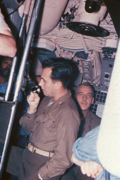
| LCDR Nicholson addressing the crew as the USS SARGO passed beneath the North Pole |
|
“Next day, Sargo resumed her northward course. The bow planes were again
frozen but this was of little worry as the 50-fathom curve and then the
100-fathom curve were passed. Speed was increased to 16 knots as Sargo
zigzagged her way toward the top of the world. Our momentary relief at being
in deep water was short-lived as the iceberg detector failed. We had to fix it
or replace it if we were to be able to return via the Bering Strait rather
than the Panama Canal. So on the following day Sargo was surfaced through 7
inches of ice in a 600 by 2,000 yard frozen polynya. Repair of the iceberg
detector was then begun. Working in twenty below zero weather, two men at a
time worked in half-hour shifts to dismantle the train mechanism and get it
below for repairs. The heavy support beam under the detector had to be cut
before it could be lowered to the deck below. During this, there was a
screeching and groaning of ice as it was being forced up and over the Sargo's
main deck. After 40 hours, with the training mechanism finally gotten below,
Sargo dove and continued zig zagging our way towards the Pole. We discovered a
lot of previously unexplored territory including a ridge subsequently named
Sargo Ridge.
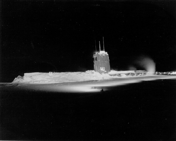
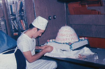
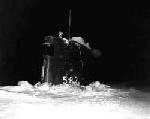
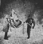
“At 0934 on February 9, Sargo passed 350 feet under the North Pole, and after announcing our arrival at the Pole, Sargo began searching for an opening. A small one was discovered and Sargo smashed through 3 feet of ice and surfaced just 25 yards from the Pole. It was 33 degrees below zero as we raised the Hawaiian State Flag alongside the Sargo. |
|
 Courtesy Robert Connelly
|
 Courtesy Robert Connelly
|
 Courtesy Robert Connelly
|
 Courtesy Robert Connelly
|
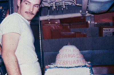
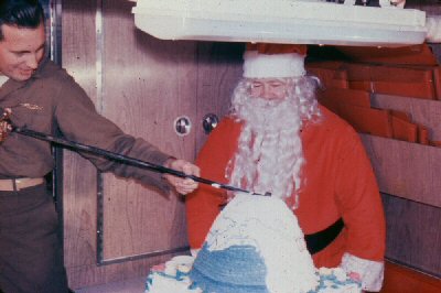
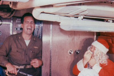
| Cutting the "North Pole" cake in the Wardroom. | |

|
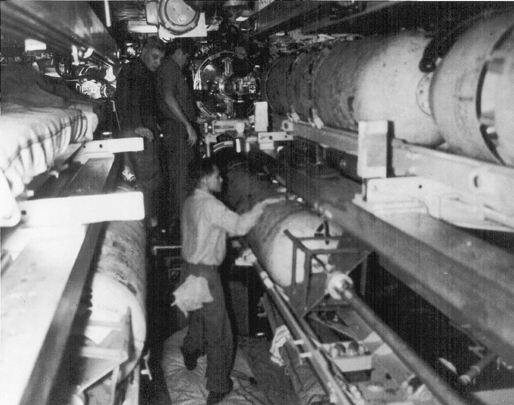
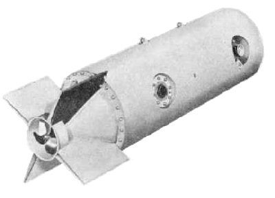
One of the problems with operating a submarine under the ice canopy of the Arctic Ocean is the concern for being able to surface the submarine in a timely manner should there be an emergency onboard (fire, flooding, etc.) and the submarine find itself in need of being "on the top." To answer this concern the use of an explosive device to punch a hole in the ice canopy was considered. The explosive device that was settled upon was the MK-19 submarine launched mine. |
 Courtesy Mike Hacking
|
|
|
The MK-13 mine was designed by the USN, as a moored magnetic-influence mine, had an aluminum casing, and weighed 1118 lbs. The warhead was 710 lbs of TorpEx. A sister project by the U.S. Army Air Corps was the MK-19, this used a better type of magnetic-influence fuse and was armed via a revolution-counting impeller. The USN evaluated the MK-19 and ordered them as the MK-19 Mod 2. One of SARGO's mission assignments was the test of modified MK-19 mines for use as an emergency method of surfacing through the ice canopy. VADM John Nicholson shared the following excerpts [with notes of clarification] from the journal he kept for the 1960 Winter Arctic Exploration cruise:
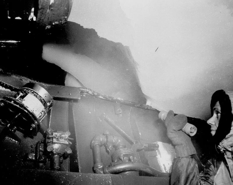
"0205 - c/c to 132 to head into McClure Strait. "Started coming up at 0743. NK and BQN [Topsounder Recorder] estimated less than 1 foot, looked thru scope. Very good visibility. Ice looked free of ridges but looked solid - I estimated 1-foot or more. "Hit somewhat slower than usual at 49-1/2 feet (indicating 6-inches). A slight blow forward and aft and she broke through with a jolt - even the deck hit fairly hard.
|
 Courtesy John Nicholson
|
| The Cockpit full of Ice. |
 Courtesy John Nicholson
|
 Courtesy John Nicholson
|
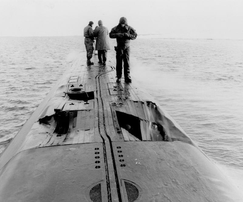
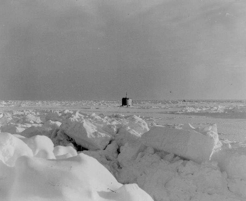
| Damage to the AFT Deck. | The SARGO surfaced in McClure Strait. |
|
"1538 surfaced about 1000 yards from two destructors through only about 1-inch of ice.
Temp only -25 but bitter cold due to 20 knot winds. Water surface very interesting with
all this new ice. Wittman says the wind has shifted and this will change conditions in
the strait. Inspected topside - found a large hole in the deck just aft of EHX
[Emergency Heat Exchanger]. Nothing serious but apparently it occurred on this
morning's surfacing. Also the UQS guard is down against the UQS dome. Decided to hold number
of surfacings to a minimum for the remainder of the cruise.
"1654 dove. Hope to surface and get ST fix to make soundings we're getting more valuable. "No opening - will continue on track to link last known soundings but will have to take conservative track. Iceberg detector + SQS-4 furnishing protection as well as UQN. "1900 - We're planning to surface as soon as possible to send sitrep + repair main circ pump. "At midnight decided to take off execute [order] until dawn. Have penetrated McClure Strait to a point which joined up previous soundings. Bottom very flat + over 200 fathoms. Ideal submarine passage.
"Still in mouth of McClure Strait enroute to Ice Station Bravo looking for a hole. "Executed on a large flat section estimated about 3-feet thick. 3-feet doesn't bother us at all anymore. Broke through at 0901 after hitting at 50-feet [ascent rate of 50 feet per minute]. A look through the scope on the way up indicated very flat absolutely no nearby ridges - I estimated thickness at 2-3-feet. "The thickness of the ice on the bridge was 22-inches this time and we were in a beautiful frozen polynya about 700 by 1500 yards surrounded by ridges 12-feet to 24-feet high. Sun was up about 1-degree. Beautiful day for pictures. Sail only came through. Ice over forward deck was all broken up. Could have broken on up but we preferred to leave deck under. "Commenced replacing the seal on STBD main circ pump at 0915. Boys are determined to beat SKATE's time of 7-hours during their winter cruise. "During Walt's [Walt Whitmann] trek to the pressure ridges he and the rifleman discovered fresh polar bear tracks. There was great excitement when the news got back. A big game hunting party was quickly formed and after arranging for proper safety signals ... off they went. They did find numerous tracks and a cave in the ice where there had been recent bears but no luck. They returned undaunted and even more eager to get one next time. "Was amazed when the Engineer came up at 1330 and said the pump was repaired and had been tested - only 4 hours + 15 minutes. Engineer also claimed they'd done it with one hand tied behind their backs. RM claimed they gotten msg out with both hands tied behind their backs. "Dropped out of this delightful spot and headed for Bravo. We really feel like we're heading home. Making a dog leg to get better bathymetry and give USNUSL a better test. "Spent some time at 130-feet testing 1BD. We really feel its working well and will not require repair. What a relief. Roshon, Page, and Walker have really come through. Will pick up spare motor + projector if it is handy. "Several large polynyas up to 5 miles long and 1-foot thick - big improvement over Canadian Archipelago."
|

|
VADM John Nicholson continues to recount his experiences during the 1960 Winter Arctic
Exploration cruise:
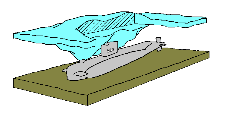
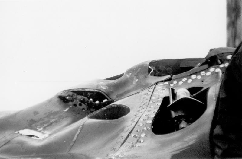
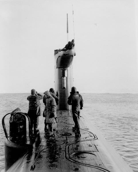
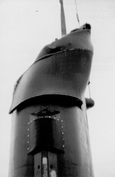
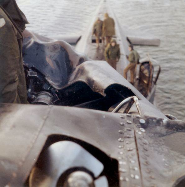
“Enroute South, the iceberg detector was jury rigged with another sonar by an ingenious system of synchros, gears and linkages devised by our crew and two designers of the iceberg detector. Tests with the modified ice detector proved satisfactory. Later Sargo rendezvoused with Ice Island T-3, drifting in the Beaufort Sea and manned by a crew of scientists. After passing under the ice island and determining it to be 4 miles by 10 miles in size and 160 feet deep, we conducted sonar tests with them and then headed back toward Bering Strait. “Just before entering the Strait, Sargo was surfaced through thick ice and a navigational fix taken. Then Sargo dropped out of the ice into 155 feet of water and cruised at 7 knots into Bering Strait -- 24 feet off the bottom. The deep ice ridges began to appear, but evading them was tougher because of the shortened and distorted ranges provided by the jury-rigged detector. Later, when a pair of deep ridges were spotted 500 yards ahead, I ordered a course to take Sargo between them. At 125 yards, the ridge off the port bow looked very deep while the one on the starboard side had disappeared. I altered Sargo's course 15 degrees to starboard and WHAM! The boat heeled to port as it was shoved down 25 feet, with a 6 degree down bubble. The conning officer sounded the collision alarm and rang up "all stop". With the depth gage reading 148 feet, almost on the bottom. I took the conn, ordered "back two thirds" then ordered ballast tanks blown while leaving the vents open. As Sargo came up, I ordered "ahead two thirds" on one shaft and we regained depth control. Sargo was clear of the ridge and all compartments reported "no damage". It was a close call. |
 Courtesy John Nicholson
|
| Artist's conception of the Ice Keel. |
 Courtesy Earl Gale
|
 Courtesy John Nicholson
|
| Damage to the Sail | Damage to the Sail |
 Courtesy John Nicholson
|
 Courtesy John Nicholson
|
 Courtesy John Nicholson
|
| Examining the damage | Sail damage | Sail damage |
|
“We determined that our modification of the iceberg detector had resulted in
unwanted side lobes on the short scales, se we decided to leave the iceberg
scope was left on the long scale, and maneuver around the ridges while still
600 yards away. Additionally, Sargo cruised 16 feet off the bottom to give
more clearance from the ridges. But late on the next day, a solid wall of ice
was spotted 800 yards ahead. Scanning the huge ice ridge showed no openings,
so Sargo was steered parallel to the ice wall for a long period until she was
able to skirt around its end and resume base course.
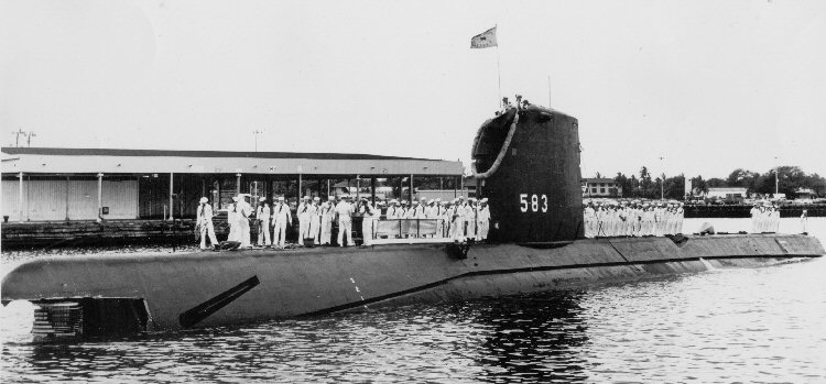
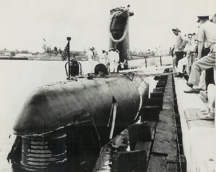
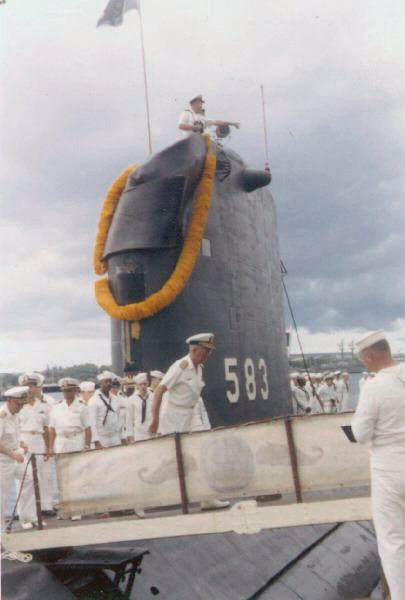
“As soon as possible we surfaced to inspect the damaged sail. It was quite a sight. The top of the sail was dished in so that one of the periscopes couldn't be raised, but the supporting members in the sail were sound. We had been very lucky. “There was just one trouble spot left – Tall Gonzales. I planned to avoid this pinnacle by 5 miles, but then the inertial navigational system chose to get out of line a bit. Despite my calculations for set and drift to compensate for the system errors, soundings showed the bottom shoaling up rapidly under Sargo and a deep ridge up ahead. I reversed course and headed for deeper water just as the boys put the inertial navigator back on the line. The corrected equipment showed we were five miles North of our estimated position, hard by Tall Gonzales. We dodged our way through another field of heavy ridges and finally reached better ice conditions. “Two days later, February 25, Sargo cleared the ice pack after traveling 6,003 miles and 31 days under the ice and successful accomplishment of a very risky operation. One crewmember summed up our thoughts, "The only ice I want to see for a long time is in a tall glass." When she returned the ship had logged 11,136 miles, 6003 miles under the ice, and all but 300 miles submerged. The winter Arctic Ocean was a great unknown and SARGO collected extensive scientific data. Arriving at the North Pole, on 09 Feb 1960 she surfaced through 36 inches of ice, establishing the U.S. Navy's capability for year-round access to the Arctic Basin, from the Pacific Ocean. |
 Courtesy Robert Fay
|
 Courtesy Donald Taylor
|
| Returning to port after a challenging deployment. | USS SARGO (SSN 583) returns to Pearl Harbor. |
 Courtesy John Nicholson
|
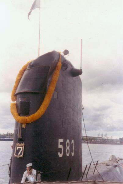 Courtesy John Nicholson
|
| Liberty | Liberty |

|
Don Taylor ET2(SS)(1960):
“on the return trip from the Arctic in 1960, a can of beer was spotted in the Lower Level Engine Room bilge. There was ice in the bilge which needless to say made it a cold beer. After two to three days of trying at various times to capture that beer, someone finally did. I never knew who got the beer or where it came from.” |

|
LT Thomas L. Walker, (1957 – 1962):
"after the collision using the Sonar repair which replaced the Sail-mounted Transducer with the BQR hydrophone that was under the Bow for iceberg detection it was said 'Well that should have been expected, move your eyes from you head and put them in your knees and see if you don't bump your head once in a while!" |

|
Bob Fay YN2(SS)(1959-1960):
“My biggest memory of SARGO was handling some 15-20 thousand letters that were sent to the ship before sailing for canceling with the time and date of the surfacing at the North Pole. I was the Yeoman at the time, and in fact, was designated by the U.S. Postal Service as a temporary Postmaster for the trip.” |
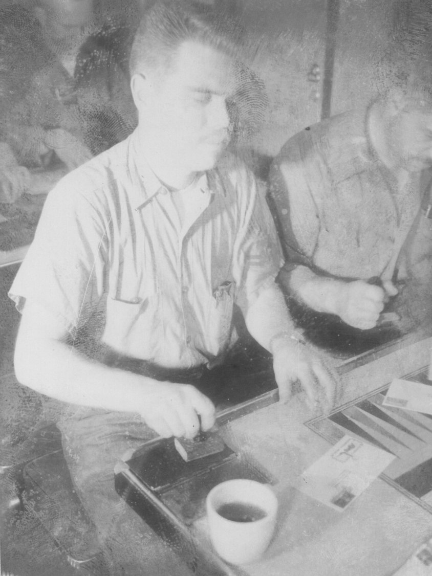 Courtesy Robert Fay
|
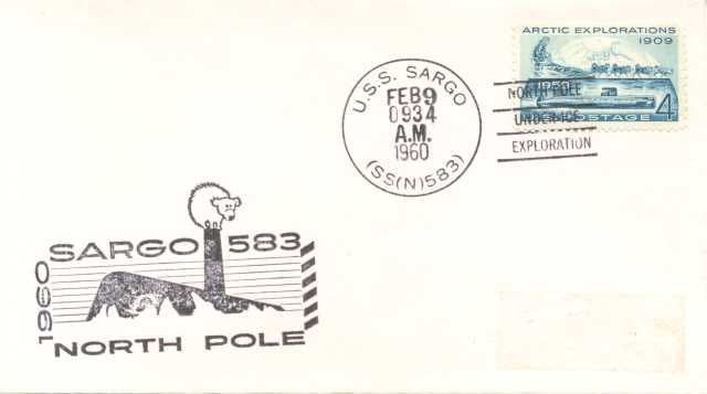 Courtesy Michael Hacking
|
| Bob Fay cancelling cachets. | The Official Arctic Deployment Cachet. |

| Robert Stewart was a civilian onboard for the Arctic deployment responsible for the continued operation of the Autonetics N6A navigation system and shared the following: |
 Courtesy Robert Stewart
|
| A cartoon which appeared in the Sargo newsletter while underway. |
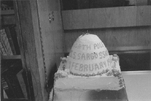 Courtesy Robert Stewart
|
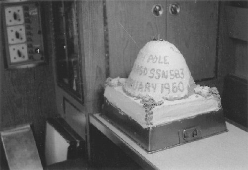 Courtesy Robert Stewart
|
| A cake baked to commemorate the Sargo surfacing at the North Pole. | A cake baked to commemorate the Sargo surfacing at the North Pole. |
 Courtesy Robert Stewart
|
 Courtesy Robert Stewart
|
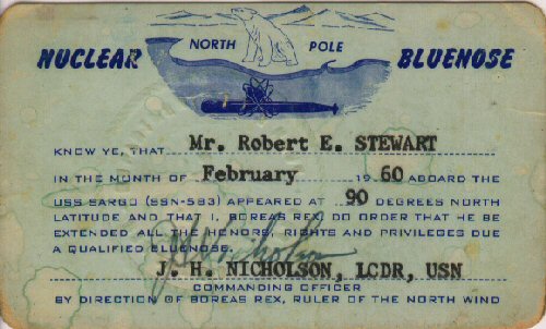
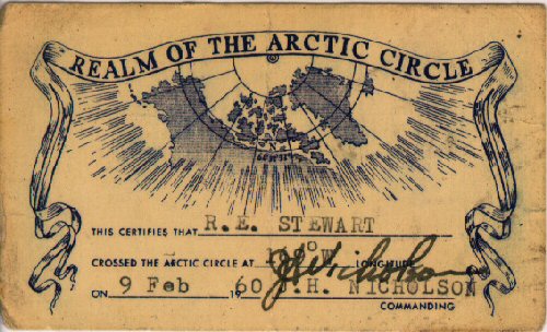
| Bob Stewart's Blue Nose Card. | Bob Stewart's card certifying his crossing of the Arctic Circle. |
 Courtesy Robert Stewart
|
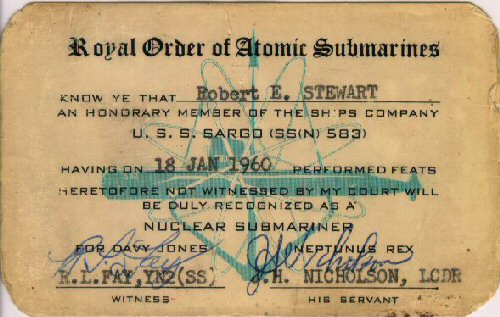
| Bob Stewart's "membership" card as an honorary member of the ship's company. |
| Following the deployment to the Arctic Robert Stewart published a report on the performance of the Autonetics N6A navigation system. The following link is to that report: |

ADDITIONAL LINKS AND INFORMATION FOR THE
1960 WINTER ARCTIC EXPLORATION
|
|
|
|
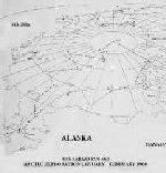
|

|

|

|

|

|

| Official Navy Photos provided to AP and UPI are shown below: |

|
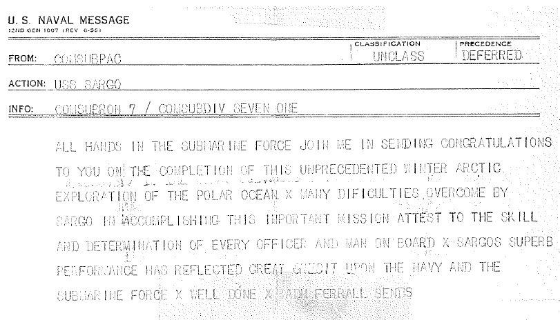
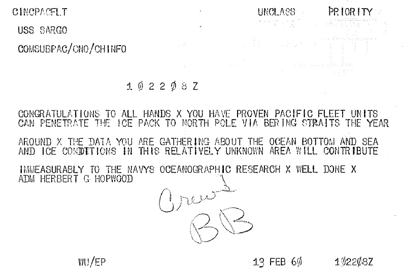
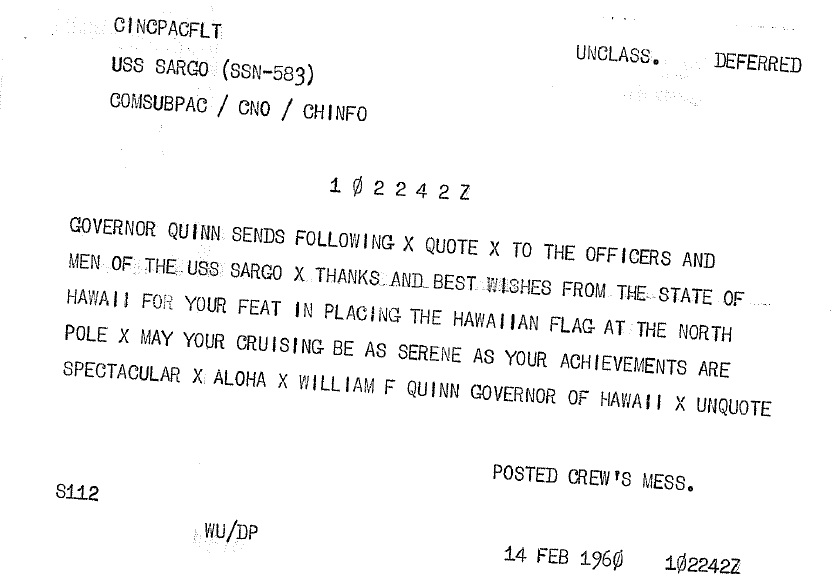
Following the ship's completion of the Arctic cruise the USS SARGO (SSN 583)
received the following message traffic:
|
|
|
 |
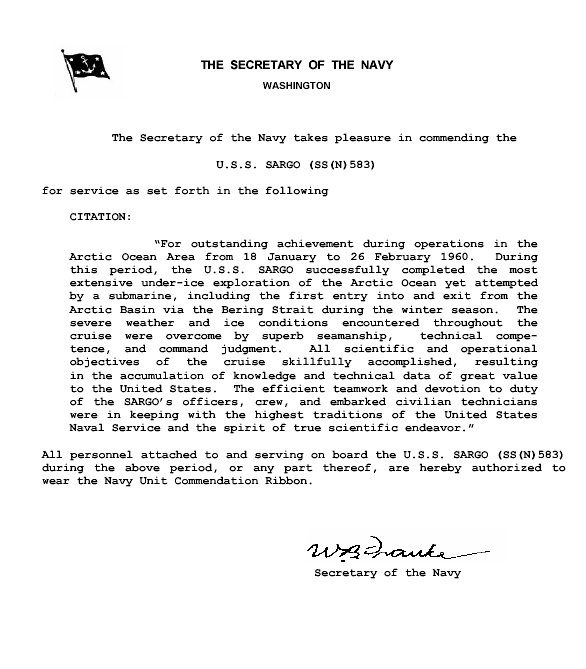
| On March 3, 1960 SARGO was awarded her first NAVY UNIT COMMENDATION AWARD for "successfully completing the most extensive under ice exploration of the Arctic Ocean yet attempted by a submarine including the first ... during the winter season ... despite severe weather and ice conditions." |
|
 Courtesy Donald Taylor
|
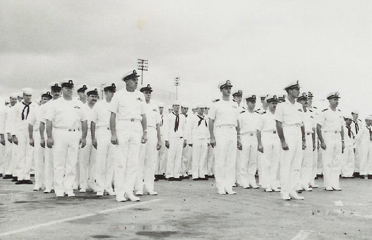
| Ship's Company Receiving the Navy Unit Commendation. |
| On 25 Nov 1960 the Commander, Submarine Force Pacific Fleet Public Information Office released the following: |
|
“Two Navymen on board the nuclear powered submarine USS SARGO (SSN-583) today
received the Navy Commendation Medal from the Secretary of the Navy for
meritorious service during that submarines Winter Arctic Exploration Cruise
earlier this year.
“Lieutenant Frederick C. Stelter, III USN, and Thomas L. Walker, Jr., chief interior communications technician, USN, received the award from Rear Admiral Roy S. Benson, USN, Commander of the Pacific Fleet Submarine Force in ceremonies on board that vessel. “Lieutenant Stelter’s award was for service as diving officer. The citation accompanying the award went on to say that Lieutenant Stelter ‘developed and perfected a technique for surfacing through thick ice, thereby contributing significantly to the operational capabilities of nuclear powered submarines in the Arctic. During sixteen surfacings through the ice, he personally directed the employment of his technique with faultless judgment and outstanding skill.’ “The citation to Walker read: ‘As leading chief petty officer of the interior communications division, Walker succeeded in devising and perfecting an ingenious variable inductance speed control which made operable a modification to a vital place of sonar equipment. Through his outstanding technical skill and ingenuity, he contributed materially to the success of the SARGO in making the difficult and hazardous transit from the Arctic Ocean through the shallow Chuckchi and Bering Seas on schedule.’ “The devotion to duty of both men was in keeping with the highest traditions of the Naval service, the citations concluded. “Lieutenant Stelter is the son of Rear Admiral and Mrs. F.C. Stelter, Jr., USN, of Headquarters, U.S. Forces in Japan; and resides locally at 747 Peltier St., Radford Terrace, Honolulu. “Chief Walker is the son of Mr. and Mrs. Thomas L. Walker of 3540 Dartmouth Drive, Santa Rosa, Calif.” |
| This is a link to a copy of the Navy Commendation Medal Citation |
 Courtesy William R. Hyde
|
 Courtesy William R. Hyde
|
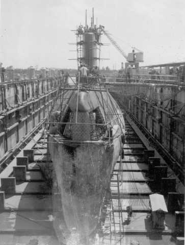
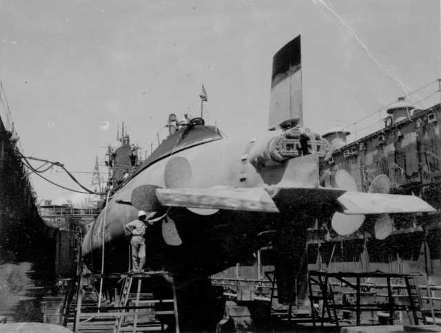
| USS SARGO (SSN 583) in Dry Dock for repairs. | The USS SARGO (SSN 583) in Dry Dock for repairs following the Arctic Expidetion. |
| The USS SARGO (SSN 583) was returned to service after spending some time in the Pearl Harbor Naval Shipyard to effect from the damage sustained on the arctic voyage. |